Covid-19 Tools #1 - Locations of Interest Maps

Good afternoon everybody.

Please also see this post highlighting cool vaccination/testing sites.

But on this post I wanted to share a few Locations of Interest maps that I have stumbled across - and perhaps you know of some others or have built one yourself? Feel free to reply in the eHealth Forum with a screen shot and link.

You can find the data source here. Can I say a big thankyou to whoever at MOH set up the Github repository. That simple act has inspired a bunch of young people up here in Northland to spend many hours seeing what they could do with the data - it has opened their eyes up to how their skills could be used in healthcare in the future - see their effort further down.

The link to each map is embedded in each title.

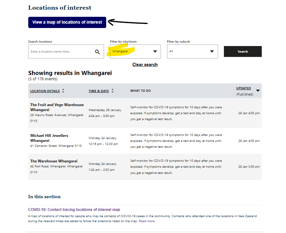
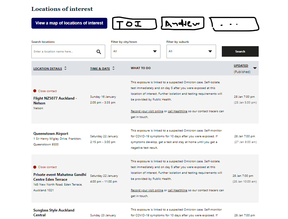
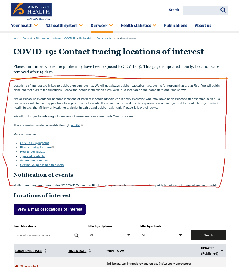
Locations of Interest by MOH

MOH’s own map is pretty simple - no frills but it works well.

image

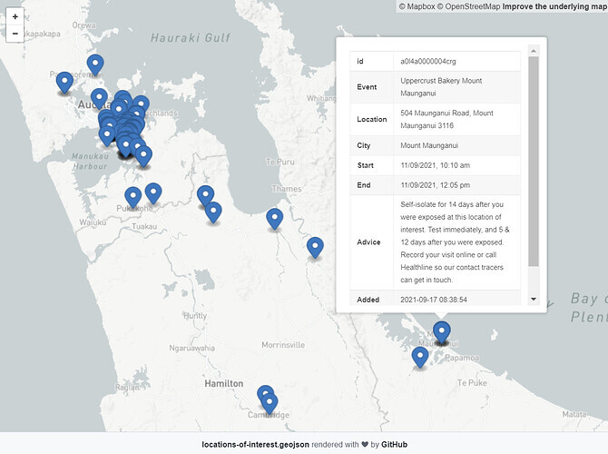
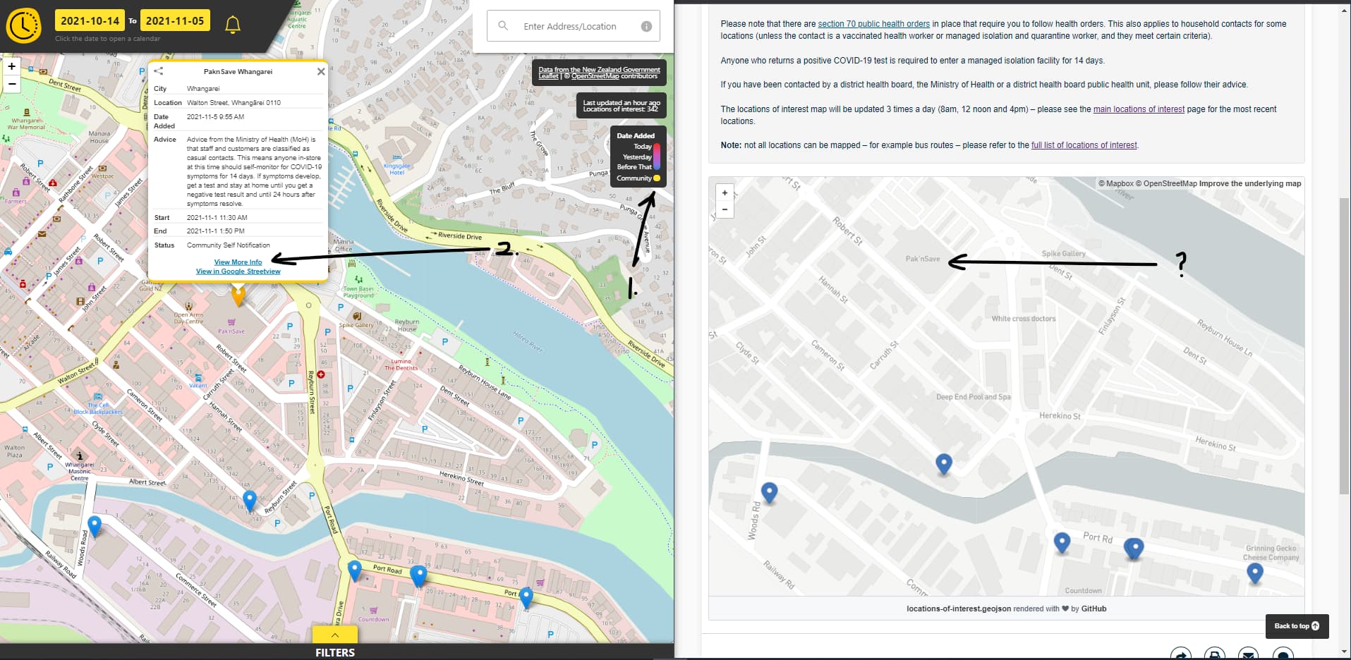
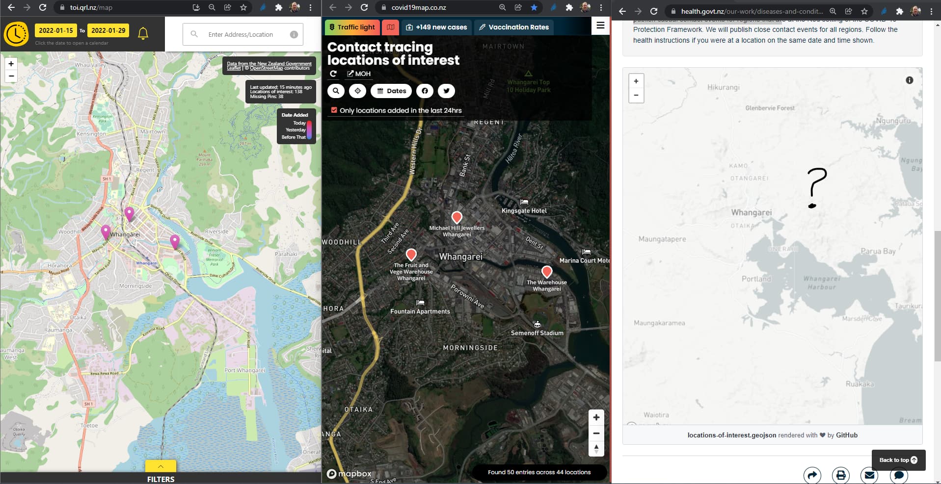
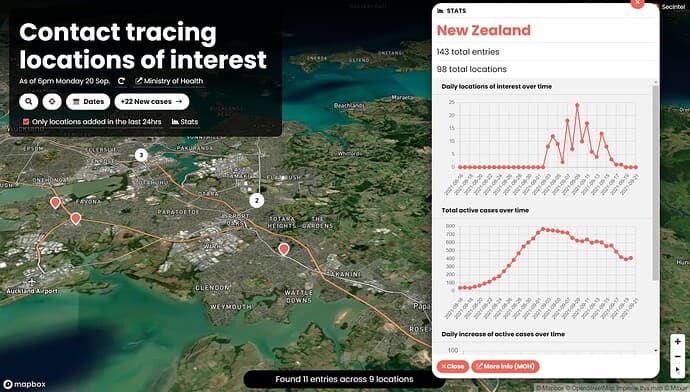
Covid19Map by Andrew Jackson

This is a beautiful map and has a different feel because of the satellite view. There is a stats box, you can filter the results by date range, and there are other neat features as well.

image

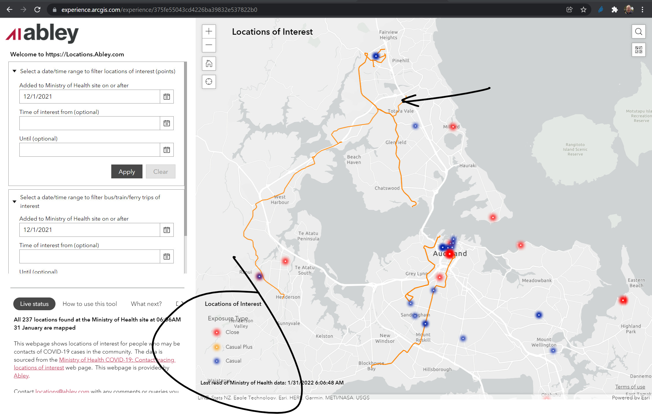
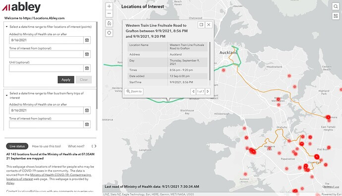
Locations of Interest by Abley

This unique feature in this map is the ability to filter by bus and train trips - I did not know that this could be done. There must be a lot of GIS talent that exists in our regional councils, lines companies and the likes.

image

Spinoff Maps by Harkanwal Singh

There is a series of maps in this Spinoff interactive, including one that shows an overview of where the “unlinked cases” are. The shot below shows the timeline feature. There are quite a few other neat Covid-19 visualizations by Harkanwal in the Spinoff.

Spinoff Gif

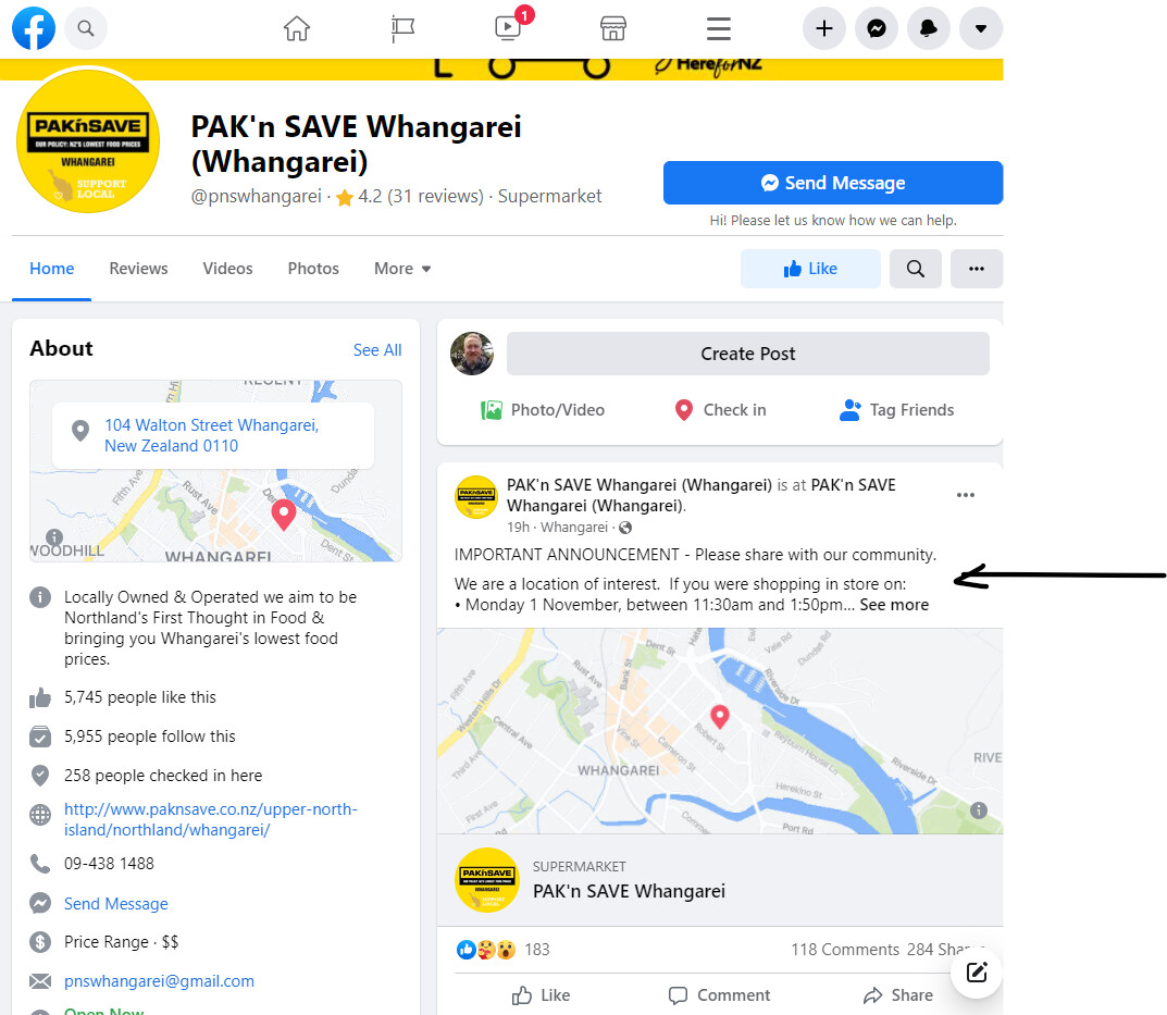
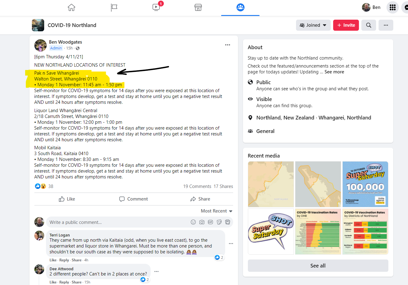
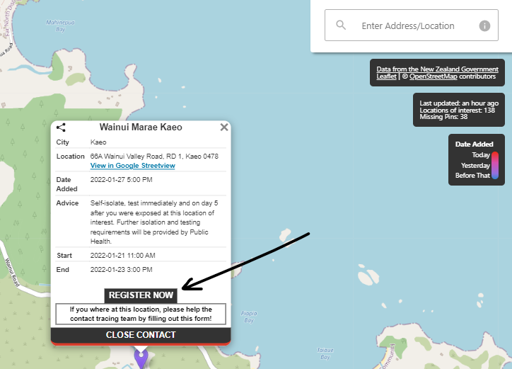
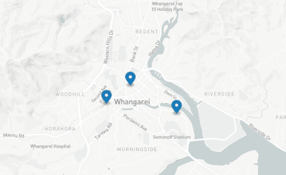
Times of Interest by Questionable Research Labs

This is a personal favorite of mine as it was built by some neat young people at our local coding club in Whangarei. While a touch confusing initially - the two sliders are fun to play with. The top one is used to filter to the date range of exposure that you are interested in. The bottom one is used to filter to when the locations were reported or updated by MOH.

Gif TOI

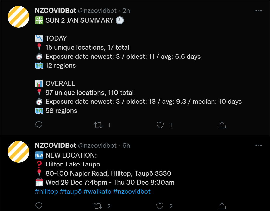
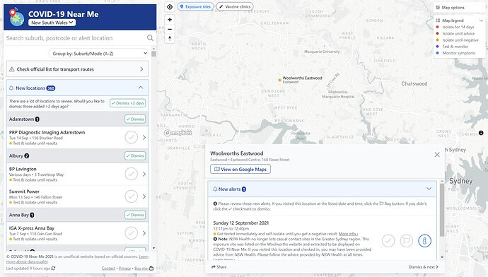
Covid-19 Near Me by Ken Tsang

And this is the best one I have found from over the ditch - very slick and it includes vaccination sites as well.

image

Others?

Do you know of any other good location of interest maps?

Have a great day. Ben.

3 Likes

Loving your work Ben!

Good morning.

There is much speculation in the media about the change in reporting of the locations of interest. Here is an example from the Spinoff.

From a community perspective in Northland it is interesting to watch what is happening in this space. As an example - yesterday (Thur) just after lunchtime our local Pak N Save notified the community that they were a location of interest - 5 minutes after being told by MOH.

The MOH list was updated at 6pm last night and shortly afterwards the Covid-19 Northland Facebook page with 6000+ members (run by 17 year old Ben Woodhouse from Boys High) alerted the community of the new locations of interest - including Pak n Save.

However - the MOH map was not showing what was on the list.

The young guys at QRL have been responding to these recent developments and have created a “Community Pin” on their locations of interest map (1). It is a form of self notification and the new pain and card are yellow and there is a link to Pak n Save’s Facebook page (2).

But it is now 11am on Friday and the MOH map still does not show Pak n Save at all?

It is nearly 20 hours since Pak n Save alerted the community themselves.

The QRL team are asking if the Github repository for the map can please be populated at the same time as the list? They (along with the other map builders above I am sure) have gone to a fair bit of effort to build these maps - and they are disappointed that they are not getting timely data.

@jon_herries - would you be able to push that message along?

I have said to QRL that MOH Digital will be under huge pressure with massive demand on their resources. I have also told them that the strategy appears to have changed regarding contact tracing and identifying locations of interest - particularly in Auckland. They came back and said something like - we don’t care, people want to know this in Northland as we are trying to stamp it out still. Fair call!

From my perspective this project has been such a great example of how data sharing can inspire innovation (check out Andrew’s latest updates) that it does appear a shame that the list/map data is not synchronized.

Again - thanks so much for enabling all of this with that GitHub repository.

2 Likes

Will pass it along.

Worth noting they are both populated manually at the moment (by different teams), so is dependent on a person with the right access being able to do it.

Jon

2 Likes

Thanks @jon_herries. I just noticed this new API below. I have let the young team at QRL know - they will update their app to pull off the API as soon as possible. Thankyou for pushing this along. I see the list-view on the MOH app has been improved too. Regards, Ben.

1 Like

Here is a useful Twitter bot that provides alerts for new locations of interest: https://twitter.com/nzcovidbot

1 Like

Morena.

We have several Covid-19 cases in Whangarei - easily found on the MOH Locations of Interest list here:

The list continues to evolve - it is much clearer than it used to be. Close contacts are more easy to spot. The bold heading and table layout is nice. A region filter might be useful as the town filter can miss spots on the map that are more rural - but I appreciate that could get cluttered.

But the MOH map has not evolved at all and is not drawing from the new API? I gather the map might update once a day, vs the API updating every hour?

In this image below I have lined up TOI, Covid19Map and the MOH map. It is nearly 24 hours since this information was released to the public in the list - but it does not appear in the MOH map?

Some people rely on the map - I personally use the maps over the list and I am sure many others do as well. I would be interested in the number of hits MOH is getting to the map view?

I am guessing that the digital team is under pressure for its time and resources, but location of interest information is actually quite important to many in the community. If contact tracing actually works and we want people who visit high risk locations to take action (monitor, isolate, test etc) - then should we not make extra effort in this space? Every chain of transmission we interrupt can lead downstream to less pressure on our medical teams.

MOH has the data and has built an API - why not pull off the API so it is presented in real time like the list?

But if there is not resource to build a map at the moment - another solution might be - why not link to the 3rd party apps above (and others) that have made the effort to connect to the MOH data source?

I note the recent discussion around HIRA etc - which includes an ecosystem of API’s built on trusted data - with apps built on top etc. Perhaps this is an small example of an outcome that HIRA will be trying to achieve?

I think it would be great to close the loop here for other reasons - I know that the young team from QRL (who built TOI) would be chuffed for some extra recognition and exposure from what they have done. We were so impressed by one of them that we hired him on a summer internship - hoping that we can spark an ongoing interest in Health IT. But our relationship with him was sparked initially by his interest in the data that MOH provided…it prompted him to get together with a bunch of friends and build the TOI website.

I am trying to predict what any hesitation might be to showcasing apps that are built on top of this data set. They could be dodgy, buggy, insecure etc. I would have thought you could assess them pretty quickly before linking to them. As a consumer I choose both of those apps above over the MOH one - as the data is real-time, and there has been no development on the MOH map since its release.

Whereas the 3rd party maps continue to evolve. Latest update I noticed on TOI is they have embedded into the card a close contact banner on the bottom and a REGISTER NOW link to create action. This particular location of interest is really important to us in Northland right now.

Perhaps a work around would be to have a caveat on the website with an email address for the public to report any obvious problems with one of the 3rd party apps?

I would certainly use that email address if I found a bug (free testers!) and at the MOH end it would be a matter of hiding the link if there was a significant problem. I guess there are other risks in being seen to endorse something, but I will keep coming back to the MOH map which is not fit for purpose at present. E.g. soon there will be so many pins on the map that it will be hard to tell which locations on the map are more important than others. The Abley site currently does a good job of differentiating the close v. casual contacts.

Perhaps another benefit MOH might get if they showcased these apps, if they did decide to build their own one day, is the ongoing design inspiration from the 3rd parties efforts.

Apologies if I am naïve to the bigger issues or realities here. If these are inappropriate ideas I am happy to be publicly educated!

PS - I mean absolutely no disrespect to the people working very hard under pressure in MOH. It is easy for people like me to lob ideas around from the sidelines when there are so many major projects being rolled out.

Regards, Ben.

1 Like

Ben, you make very good points. I’d love to hear from our @hnz-tewhatuora colleagues about if your suggestions could be actioned (and promptly). I’d also like to see the 3rd party maps linked to in the map page.

I see that the MoH map has now been updated. It must update mid morning:

image

There is also a glaring UI issue with the MoH map and List:

https://www.health.govt.nz/our-work/diseases-and-conditions/covid-19-novel-coronavirus/covid-19-health-advice-public/contact-tracing-covid-19/covid-19-contact-tracing-locations-interest

https://www.health.govt.nz/our-work/diseases-and-conditions/covid-19-novel-coronavirus/covid-19-health-advice-public/contact-tracing-covid-19/covid-19-contact-tracing-locations-interest/covid-19-contact-tracing-locations-interest-map

They both have a LOT of unnecessary gumpfh above the list and the map, which requires a very annoying scroll to reach the ‘meat’. This really needs be de-emphasised in some way.

Screenshot 2022-01-29 11.59.39

Morena.

With the increase in numbers of bus trip and plane flights I was prompted to use the Abley site again.

It is pretty clever what they can do to visualize travel journeys.

And the other thing I noted was that the pin colour is now based on the definition of exposure type. I do like this as the action (isolation/testing) a person should take is different in each circumstance.

Many people will not know about the Abley site. Another site that may be worth consideration of linking from the MOH list page?

Cheers, Ben.

1 Like